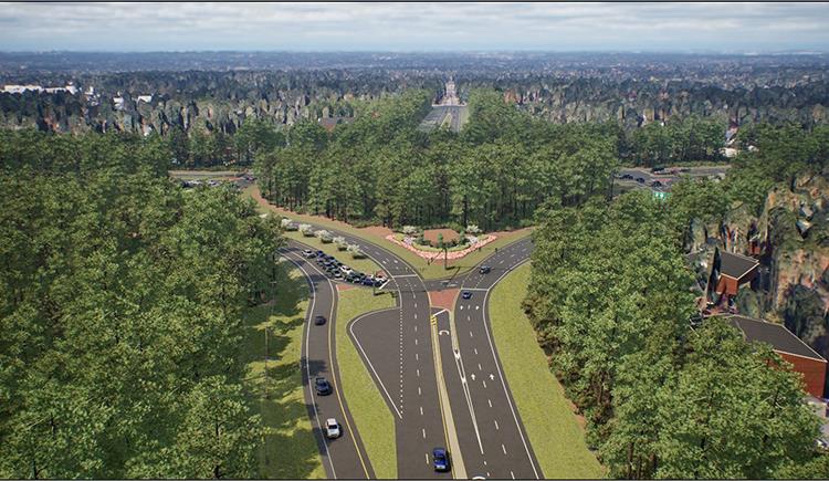
After more than a decade of planning and public input, state transportation officials have unveiled a new design for the Pinehurst traffic circle that aims to improve safety, preserve its historic character, and meet growing traffic demands.
Reuben Blakley, Division Engineer for the N.C. Department of Transportation (NCDOT), presented the updated plan during a recent Sandhills Metropolitan Planning Organization meeting. The redesign is part of State Transportation Improvement Program (STIP) Project U-5976, launched in 2013 to address increasing congestion and safety concerns at the iconic intersection.
Located in a National Historic District, the Pinehurst Traffic Circle serves as a gateway to the Village of Pinehurst and plays a critical role in regional travel. Daily traffic through the circle is expected to nearly double by 2050, with projections reaching 80,000 vehicles per day.
The final design was shaped in large part by extensive community engagement. More than 800 residents attended public meetings last summer in Aberdeen, Pinehurst, and Carthage, and over 600 public comments were submitted. Based on that feedback, NCDOT made several key changes to the original proposal.
“This design incorporates community input and balances historic preservation with future traffic demands,” Blakley said.
The chosen concept — a modified Continuous Flow Intersection — maintains the circle’s visual character while improving traffic flow and reducing the need for extensive tree removal and land acquisition. NCDOT says the changes will also lower the overall project cost.
Construction is expected to begin sometime after the 2029 U.S. Open and finish before the 2035 tournament. The timeline is being coordinated with another major project: the widening of U.S. 15-501 north of the traffic circle (Project R-5927), in an effort to minimize disruptions.
More information on the project and future updates will be shared by NCDOT as planning continues.

